Cloudy with a chance of waterfowl
Radar technology informs the weather forecast…and plays an important role in conservation

Each morning, we tune into our local radio or TV station or swipe our smartphone to learn what Mother Nature has in store for the coming day—and weekend.
Meteorologists deliver these weather reports. They are trained scientists who make their forecasts using an array of technologies, including weather surveillance radars (WSRs).
But during the migration season meteorologists may observe large concentrations of activity on WSRs they rarely, if ever, mention while delivering the forecast.
Why? Because the waves of movement they’re seeing aren’t created by atmospheric conditions. On a clear day, near sunrise or sunset—they’re likely generated by birds’ wings—hundreds of thousands of them.
Winnipeg-based CBC TV meteorologist John Sauder says you can catch sight of migration activity on a WSR “if you’re looking for it.” Sauder admits that when your job is to provide reliable and timely forecasts on a deadline, you don’t spend much time trying to identify flocks of migrating mallards.
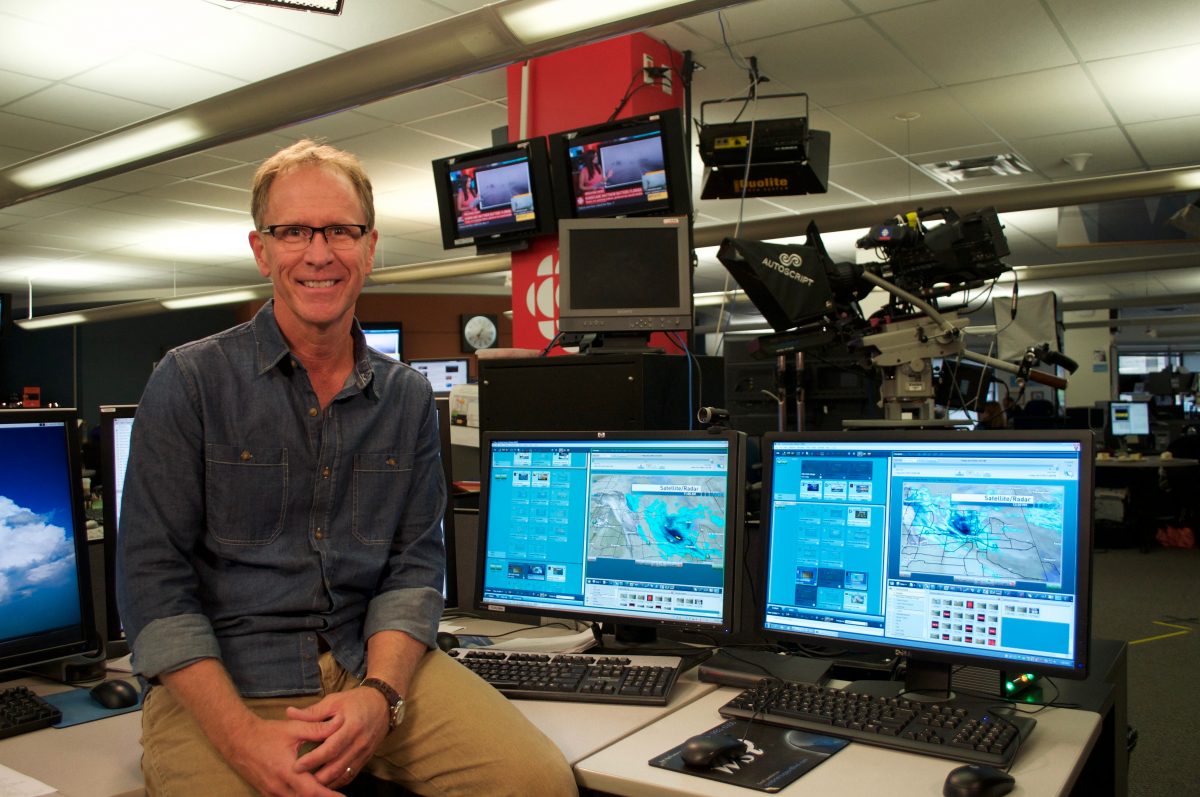
©DUC
From rain to waterfowl, the same technology that helps meteorologists forecast the weather also allows researchers like Ben O’Neal to better understand the migratory journeys of waterfowl, and is guiding important conservation work.
O’Neal, a doctor of ornithology and professor at Franklin College in Indiana, was keen to explore the role WSR technology could play outside the weather room, capturing winged movement “largely invisible to the human eye.”
“Ninety per cent of bird migration is nocturnal… and much of it occurs at altitudes of half a kilometre or higher,” says O’Neal. “Even on a bright, moonlit night we won’t see it, and we often don’t hear it.”
As a PhD student at Illinois University in the autumn of 2007 and 2008, O’Neal used a WSR and thermal infrared cameras to monitor the movement of dabbling ducks in the Illinois River Valley.
By using both pieces of technology, he was able to cross-reference data collected from each system, and show the reliability of WSRs in tracking the movement of waterfowl.
The technology and resulting data proved useful for the largest wetland restoration in the history of Indiana.
“Here in Indiana, the biggest wetland restoration effort … occurred in the last five years on the southwestern border of our state, where you’ll find the Wabash River,” says O’Neal.
He says movement captured by radar shows how migratory birds use and rely on the Wabash River, and surrounding floodplains. “[It] was really welcome justification for that project.”
O’Neal says the use of WSRs to study biological targets (birds, bats, arthropods) continues to grow and help inform and support conservation work.
“It’s a very fertile area of research…that’s robust from a scientific standpoint.”
Learn more about spotting birds on weather surveillance radars with John Sauder in Episode Six of the Ducks Unlimited Canada Podcast.
Outdoor classrooms unlock the wonders of wetlands
School field trips connect Alberta youngsters to nature.
New Habitat on the Old River Farm
A partnership on the Thames River is part of a green infrastructure awakening.