Finding common ground
Remote sensing analysts from Ducks Unlimited Canada, First Nations technicians and Indigenous Guardians are mapping a staggering number of boreal wetlands in the Northwest Territories. Blending science with traditional knowledge will map the future for northern communities…and conservation.
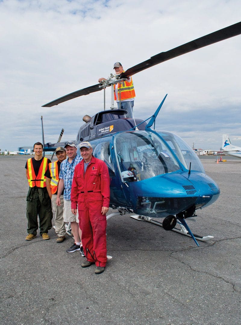
This July, Paul Betsina spent five days in a helicopter, flying so low he thought he could “reach out and grab the treetops.” After six-hour days scanning the terrain, battling motion sickness and recording data on a worksheet in close quarters, Betsina’s tired. He’s happy to be back in Yellowknife spending time with his three kids and catching up on his work as a welder.
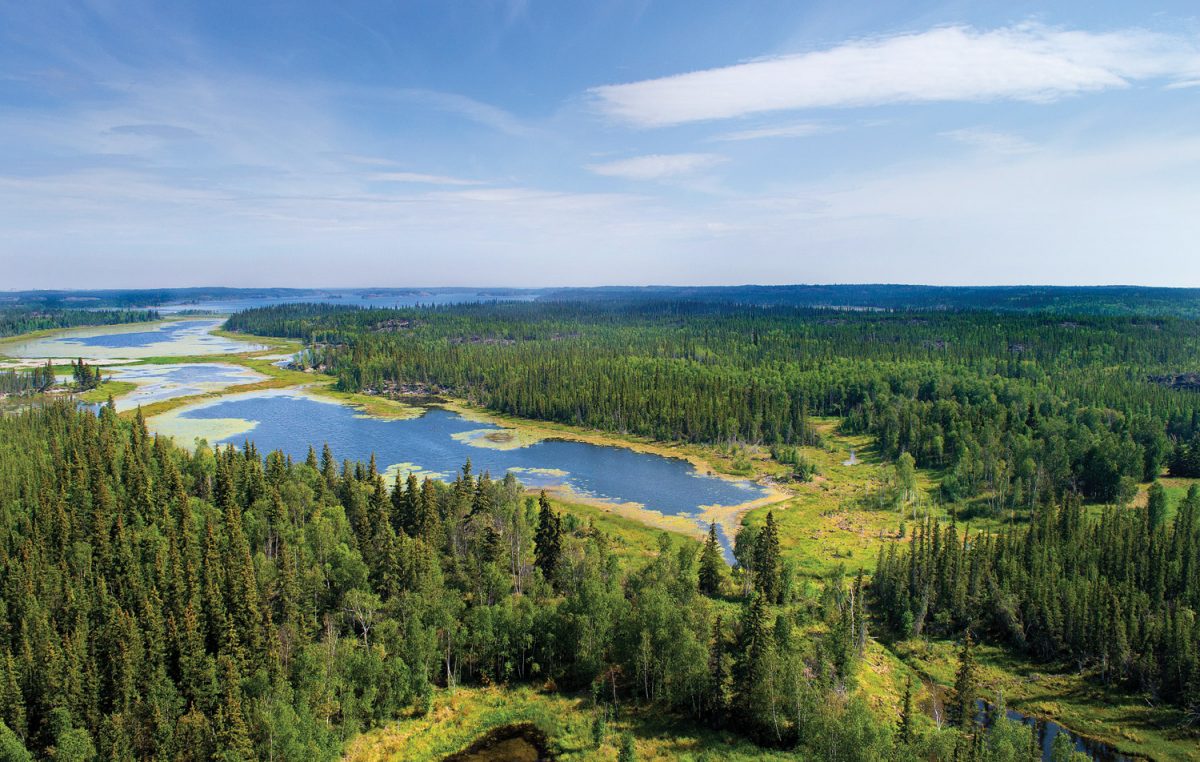
Betsina, from the Yellowknives Dene First Nation, was part of a field crew surveying and mapping boreal wetlands in Akaitcho Néné, home to four Dene First Nations. The land ranges from alkaline flats in the south to lakes, rock and spruce before transitioning to the treeless tundra.
Betsina is proud of the pilot project that marries his—and his people’s—knowledge of the land with science. When complete, it will help his community make informed decisions about the land. And there’s a lot of ground to cover: approximately 77 million acres (31 million hectares).
©DUC
Mapping for the future
“It’s a large undertaking,” says Kevin Smith, Ducks Unlimited Canada’s (DUC) national manager of boreal programs. Smith spent the same week flying over the Slave River Delta with another crew out of Lutsel K’e, a small community on the south shore of Great Slave Lake. The wetlands around there, he says, were “loaded with ducks.”
This year, DUC signed a Memorandum of Understanding (MOU) with the Akaitcho Treaty 8 Tribal Corporation, which helps support the wetland mapping project.
“We’re excited to work directly with the Akaitcho under this collaborative partnership,” says Smith. “It’s an innovative model for building an integrated, long-term conservation relationship through the entire life of the project.”

©DUC
DUC and its partners selected the southeastern region of the Northwest Territories because of its significance to waterfowl and other migratory birds, and also because of imminent land-use planning initiatives. Although satellite maps exist of the area, there’s still key knowledge gaps about the diversity, density and types of wetlands here.
There are three phases to the wetlands mapping project. Crews of DUC staff, DUC-trained First Nations technicians like Paul Betsina, and Indigenous Guardians collected data from aerial fly-overs this summer in certain parts of Akaitcho Néné. These reconnaissance flights will provide empirical data that remote sensing analysts can use to create more accurate maps.
DUC technicians and Indigenous Guardians will take these maps back to people in the Dene communities who will incorporate their traditional knowledge. Then, DUC will produce a final map.
Smith says his team will maximize the use of the data. The maps will inform DUC’s own conservation planning efforts in the boreal. And it will help local communities make decisions about how to manage their territory for protected areas initiatives, treaty rights, recreation, and sustainable land use for industry.
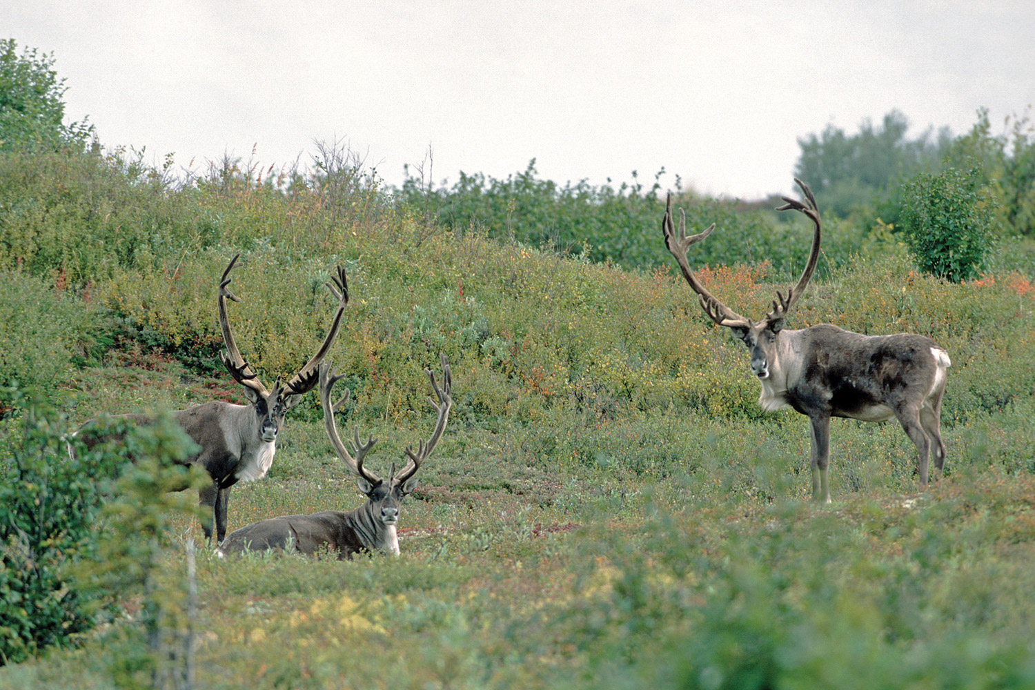
“By combining our collective knowledge, we’ll be able to show where important caribou and waterfowl habitats are, for example,” says Smith.
“We want to establish a two-way knowledge conduit with the communities to support their land use planning efforts with assistance and information.
“This won’t be a report that sits on a shelf.”

©DUC
Steven Nitah: Networking in the North
Steven Nitah is a former Lutsel K’e Dene First Nation chief. His connection to the land is strong. Raised by his great grandparents on the land around Lutsel K’e, he has “memories of family unity” while spending the first ten years of his life camping, trapping small game, netting fish, and learning how to scrape and treat moose and caribou hides.
“At this time of year, we’d be out on the barrens, harvesting caribou, collecting blueberries and medicinal plants,” says Nitah. In winter, he trapped martin, lynx, fox and wolverine, travelling by dogsled on the same frozen wetland network his grandfathers used as travel routes.
“The Dene are a Shield people—we are either on the rock or on a wetland,” says Nitah.
In his teenage years, Nitah experienced government policies that led him to a career focused on fostering his people’s responsibility to the land and reclaim their cultural identity in the process.
Now, as a lead negotiator for his people, Nitah brokers relationships between governments, non-government organizations, industry and First Nations. The agreement he helped negotiate between DUC and the Akaitcho Treaty 8 Tribal Corporation fits his people’s long-term vision for the land.
He doesn’t have to look far to find his motivation.
In and around Yellowknife are lands, lakes and wetlands laden with arsenic, a toxic legacy of the now-defunct Con and Giant gold mines. Media report toxic levels in local water. Residents are warned not to swim, eat the fish, or harvest berries.
Nitah believes that the Dene and DUC are building a natural relationship through the wetland mapping project.
“The land manages itself, but we have to find ways to manage each other,” says Nitah. “Conservation is one of those tools.”
©DUC
Paul Betsina: Bridging modern and traditional worlds
When he was a youngster, Paul Betsina’s grandparents tied a small strip of beaver pelt around his wrist. They believed the animal’s spirit and work ethic would transfer to him.
It seems to have worked. Betsina shares the beaver’s industrious nature. He’s raising a family. He owns a welding business. He’s serving a second term as a councillor on the Yellowknife Dene First Nation. He first learned of wetland mapping from Nitah and Smith at a council meeting. Betsina’s interest piqued when he heard that survey crews would be recording and sharing locations of lichen and small shrubs as part of the project. These plants are a key part of the caribou diet.
“Of course we are concerned about caribou and what they eat and what’s left,” Betsina says. “Up North, this information isn’t as well documented.”
“The chiefs and council were behind the project 100 per cent.” says Betsina. When Steve Nitah asked him to work on the mapping survey as a First Nations technician, Betsina jumped at the chance.
From the helicopter, Betsina identified a caribou route carved through the bush. He pointed out the remains of a snowmobile trail he and his family use to get to Lockhart Lake in the winter to do their trapping. At one destination, he saw an ancestral burial ground: “I was able to visit and pay my respects to the ancestor’s family afterwards.”
Betsina soon learned the difference between bogs and fens, and the names of plants that make up different wetland types.
His favourite moment? Seeing a herd of musk oxen. “I’d tasted their meat but had never seen them before.”
Although Betsina is modest about his contributions, his experience allowed him to see, in a tangible way, the survey’s long-term benefits.
“Knowing certain locations, like old villages, gravesites, good cabin spots, places for traditional teachings, will help us identify areas for development that won’t disturb these lands.”
He’s looking forward to pointing out these areas on the map to his kids. They grew up with beaver pelt wristbands, too.
©DUC
Seeing the big picture
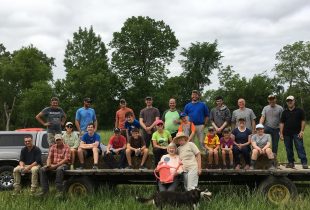
In Yellowknife, Betsina has met up with his survey crewmates: Kevin Smith, DUC conservation specialist Mark Kornder, DUC GIS specialist Rebecca Edwards and Adam Spitzig, a GIS/remote sensing analyst from Ducks Unlimited, Inc. Over dinner they debrief their survey work and share their experiences.
All agree they’ve seen amazing landscapes, including alkaline flats and wetlands “chock full” of waterfowl. The musk oxen herd and wild bison sightings were highlights. They broke a record number of surveyed wetlands: more than 100 in one day.
Edwards realized the value of their verification work when a previously mapped green swath of fen “turned out to be boulders.” Smith relayed dramatic examples of climate change at work, such as dried up wetlands and other landscape changes. “We saw an entire six-square-kilometre aspen forest that had sunk right below the waterline,” says Smith.
Crew members also co-ordinated several regional workshops to share what they’ve learned so far with local stakeholders and Indigenous communities. Spitzig noted there was a turnout of 20 people at Lutsel K’e. There was a good community meeting in Fort Resolution, too. “There were good questions about the Delta; it’s the heartbeat of the area,” says Smith.
“We’ve only seen a snapshot of their land. Wetlands are good indicators of environment change. That’s why engaging with elders and youth, who’ve seen changes in the land over a longer period of time, is so important to our understanding of what these wetlands might look like in the future.”
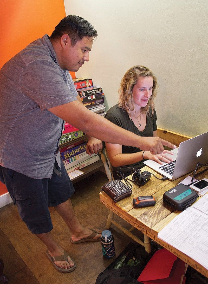
The crews will spend a few days downloading their data. Some of them get back in the air, this time in a fixed-wing plane, to continue their survey work. Soon their observations will be factored into the larger map and provided to the people who, like them, will use it.
It’s a big job, but someone’s got to do it. A healthy future for this land—and the people and animals that share it—depends on it.
The Akaitcho mapping project is also supported by the North American Wetlands Conservation Act, The Pew Charitable Trusts, Ducks Unlimited, Inc., the Hewlett Foundation and Environment Canada.
Using space to cover more ground
In the last 20 years, DUC has used satellite surveys to map more than 400 million acres (162 million hectares) of boreal forest to build a comprehensive wetland inventory. Satellite imagery is an important tool for mapping such a large area. The Akaitcho Néné project adds many more acres to this ongoing project. Here’s how it works:
Above the Earth: Satellites collect imagery of broad expanses of the Earth in a number of wavelengths.
On the ground: DUC uses field-based information from the ground (including traditional knowledge), helicopters and planes to provide ground truthing. This helps them interpret and classify the satellite images and provide accurate results.
In the lab: DUC uses computers to process the satellite imagery into a wetland classification that then can be used for land use planning, research, and spatial analyses to better understand wetlands and how they are changing.
With partners: Wetland inventories can then be integrated with other information, such as providing calibration information for NASA Earth observation flights to determine how resilient wetland ecosystems are to climate change.

Stewards of the land: Indigenous Guardians
Indigenous Guardians act as stewards on the ground. They walk the land, study animals and monitor development on behalf of their communities.
They are taught by elders about traditional teachings such as medicinal plant identification and use, subsistence harvesting, and cultural heritage.
There are about 30 Indigenous Guardian programs across the country. In March, the federal government invested $25 million in seed money to build a National Indigenous Guardians Network.
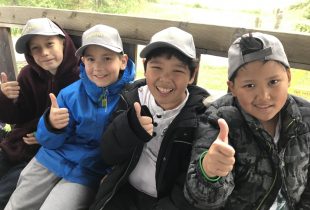
Outdoor classrooms unlock the wonders of wetlands
School field trips connect Alberta youngsters to nature.
New Habitat on the Old River Farm
A partnership on the Thames River is part of a green infrastructure awakening.